Rustenburg & North West Mobile Field Team

GPR Scanning & Utility Detection in Rustenburg & North West.

With a dedicated North West field team based in Rustenburg, GPR Metrics provides rapid-response Ground Penetrating Radar scanning, underground pipe and high-voltage cable detection, and engineering utility surveys for mines, smelters, industrial plants, and municipal projects across the North West Province.

Dedicated Rustenburg mobile field unit for fast North West site dispatch
Mining, concentrator, smelter & industrial plant HV cable and pipeline locating
Survey-grade CAD (.DWG), Google Earth (.KML) & PDF utility reports for mine safety files
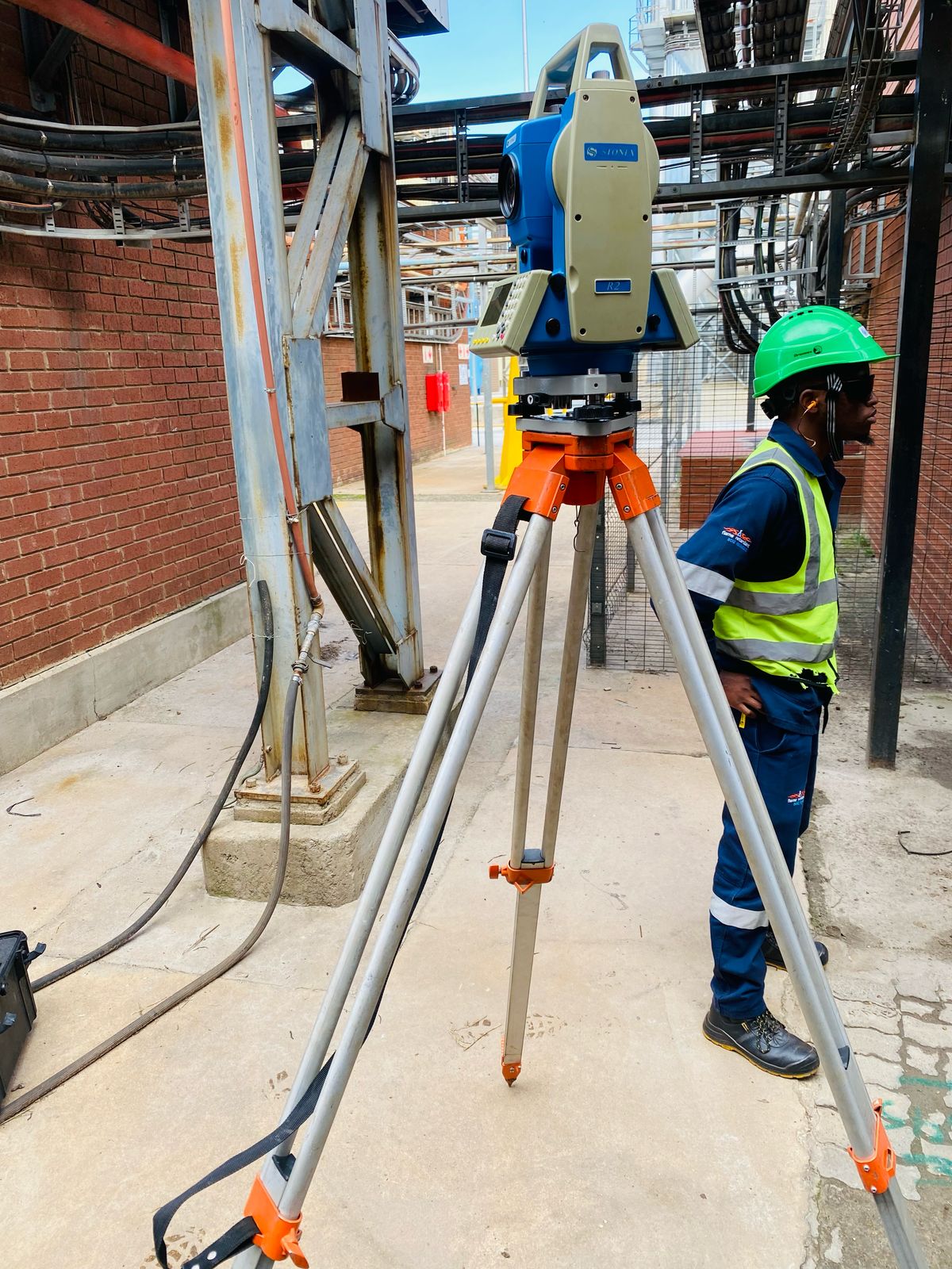
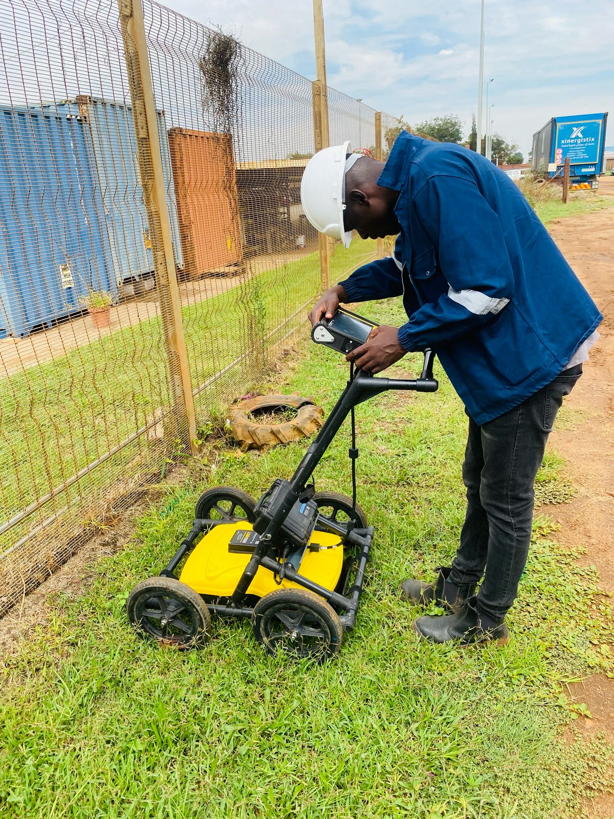
GPR Metrics surveyor and utility detection technician at industrial and mining plant near Rustenburg
Rustenburg Dispatch · Mining & Industrial Ready Equipped with LMX200 GPR, RD8200 EM locators, and Stonex Total Station/GNSS for complex mine and plant corridors.

Request a Free Quote

10% Off First Service

Tell us about your project and our team will respond promptly.

Direct Assistance: Call 061 766 8359 · WhatsApp 061 766 8359 · Alt: 010 746 3891

Up to 4m+ Depth Subsurface GPR & EM pipe/cable locating + 500mm concrete slab imaging
Same-Day Markings High-visibility surface paint & depth callouts so crews can dig or core immediately
CAD, KML & PDF Maps Survey-grade digital utility drawings & reports for engineers and safety files
24–48hr Dispatch Rapid mobile site deployment from Johannesburg & Rustenburg nationwide

Trusted on major infrastructure, municipal & commercial sites

Gautrain Johannesburg Roads Agency (JRA) Eskom Freelance Geomatics
Solutions By Project Need

Complete underground utility detection, radar scanning & pipeline solutions.

Select the exact subsurface investigation or pipeline service your project requires—from pre-excavation sweeps and slab coring clearance to CCTV camera diagnostics.

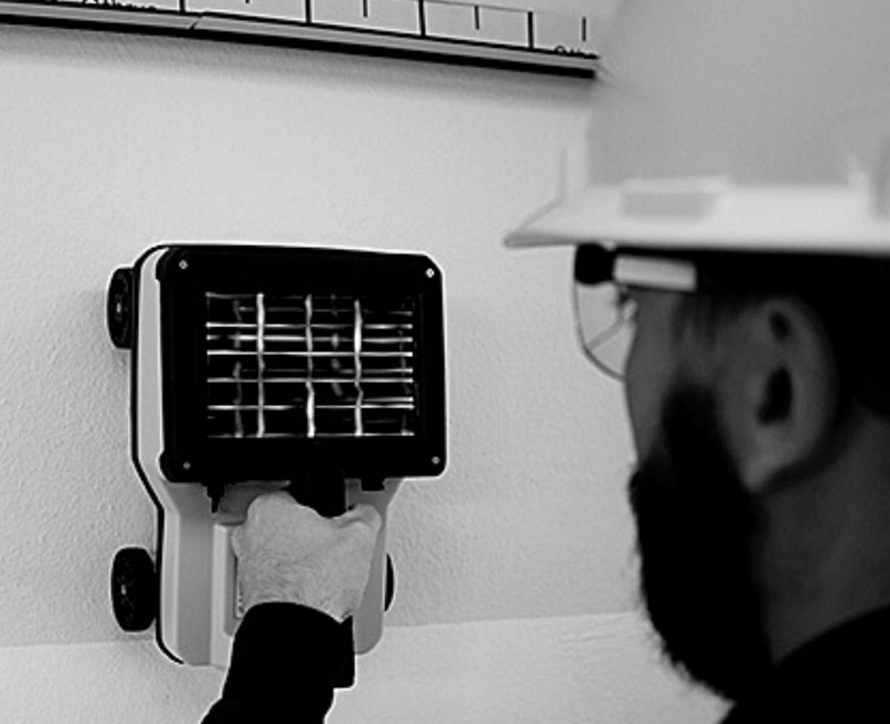
GPR Metrics technician operating Sensors & Software LMX200 Ground Penetrating Radar on site Subsurface & Concrete
For Civil Contractors, Engineers & Concrete Cutters

Ground Penetrating Radar (GPR) Services

High-resolution radar scanning to locate buried utilities, map rebar & post-tension tendons before core drilling, and detect subsurface anomalies.

Explore GPR Scanning Services →
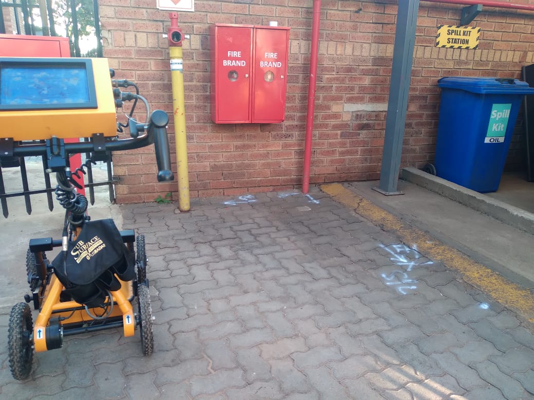
Underground utility and service detection surface paint markings All Buried Services
For Excavators, Civil Crews & Project Managers

Underground Utility & Service Detection

Complete underground scanning services combining GPR and electromagnetic locating to detect buried water pipes, electrical cables, and fibre in one visit.

Explore Underground Utility Detection →
Concrete and reinforcement GPR scanning on structural slab Rebar & Post-Tension
For Concrete Cutters, HVAC & Structural Engineers

Concrete & Reinforcement Scanning

Non-destructive slab and wall scanning to map rebar grids, post-tensioned tendons, embedded conduits, and cover depth before core drilling or cutting.

Explore Concrete & Rebar Scanning →
Georeferenced CAD and GIS underground utility mapping survey CAD, GIS & KML Maps
For Consulting Engineers, Architects & Planners

GPR Utility Survey & Mapping

Survey-grade buried services surveys using Stonex Total Station & GNSS to deliver georeferenced AutoCAD (.DWG), Google Earth (.KML), and PDF utility reports.

Explore GPR Utility Surveys →
Underground water and sewer pipe detection Metal, PVC & Concrete
For Plumbers, Trenching Crews & Municipal Projects

Underground Pipe Detection

Accurately locate and map buried water mains, sewer lines, gas pipes, and stormwater drains—whether metallic, PVC, HDPE, or fibre-cement.

Explore Underground Pipe Detection →
Underground electrical and fibre cable detection using RD8200 locator Power & Fibre-Optic
For Electrical, Fibre & Earthworks Contractors

Underground Cable Detection

Pinpoint live high- and low-voltage electrical power cables, street lighting feeders, and telecommunications or fibre ducts before digging.

Explore Underground Cable Detection →
Tangible Project Outputs

What you actually receive: Sample deliverables & site markings.

You don’t just get a technician walking around with a scanner—you get immediate physical markings on the ground plus engineering-grade digital utility maps for your design and safety files.

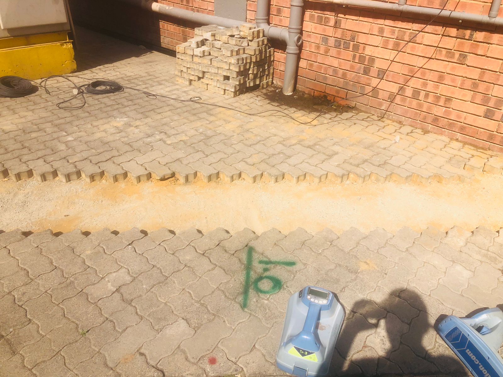
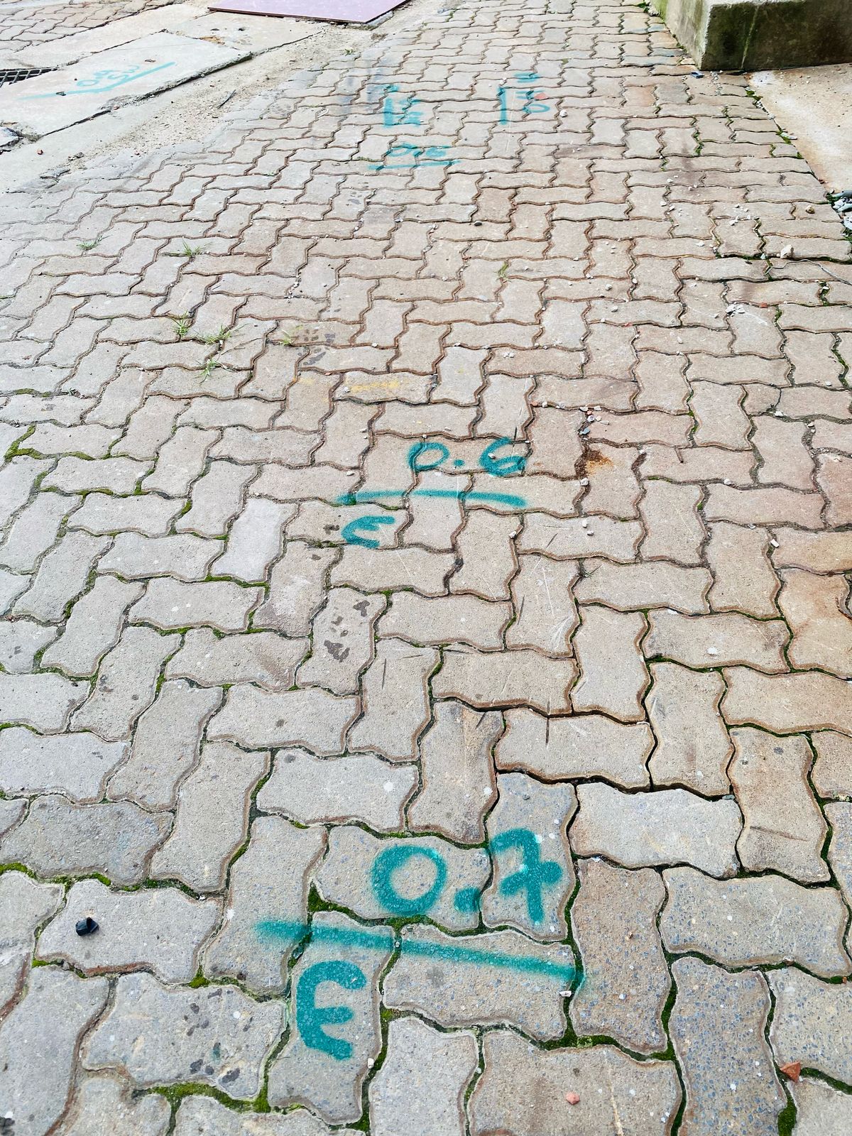
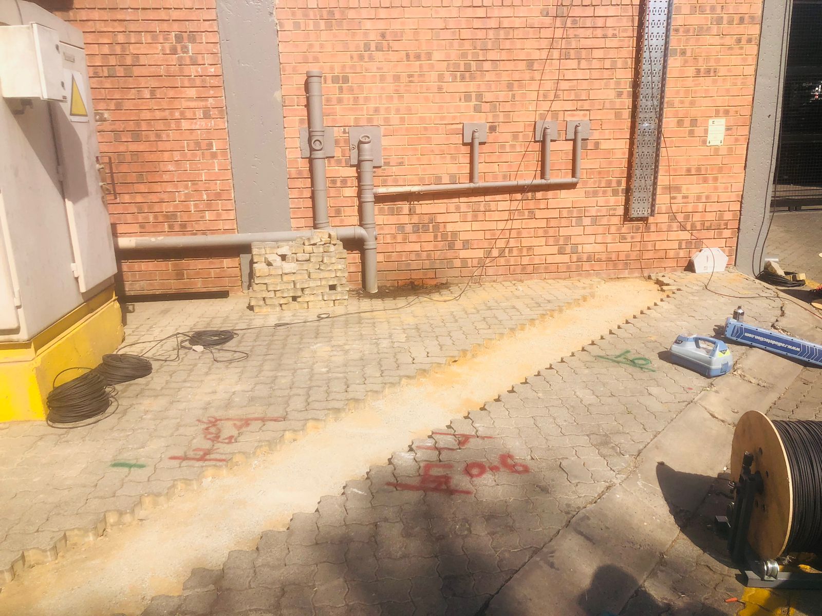
Color-coded underground utility spray paint markings on paving with depth callouts Output 01 · Same Day

Immediate On-Site Surface Markings

Every detected water pipe, power cable, telecom sleeve, or rebar grid is clearly marked on the ground or concrete slab with alignment arrows and estimated depth callouts so your crew can work safely right away.

Color-Coded Paint / Chalk Depth Callouts (m) Coring Clearance Grid
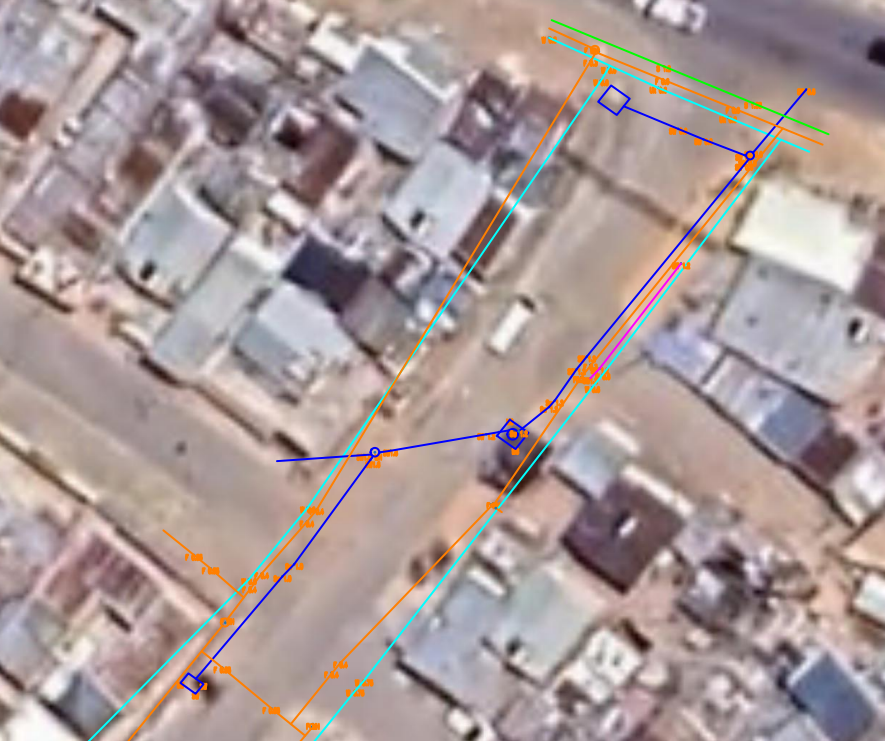
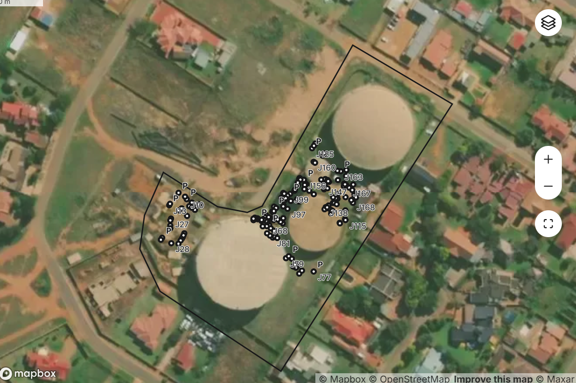
Georeferenced CAD and Google Earth KML underground utility map overlay Output 02 · Digital Map

Georeferenced CAD, GIS & Google Earth Maps

Surveyed with our Stonex GNSS & Total Station instruments, all detected underground utilities are plotted onto high-resolution aerial imagery and CAD drawings for your engineers and architects.

AutoCAD (.DWG / .DXF) Google Earth (.KML / .KMZ) PDF Plan Drawings
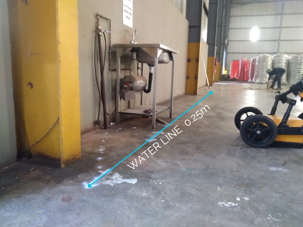
Annotated utility detection field report showing waterline and cable positions Output 03 · Full Report

Annotated Utility & Radargram Verification Report

Comprehensive project documentation featuring annotated site photographs, radargram depth profiles, utility schedules, and methodology sign-off for your construction health & safety file.

Annotated Site Photos Radargram Profiles Depth & Utility Schedule
North West & Platinum Belt Expertise

Local Rustenburg team for mining, industrial & civil utility detection.

Mining and industrial processing sites around Rustenburg, Marikana, and Brits feature high-risk underground networks of medium/high-voltage power feeders, process water mains, tailings pipelines, and fibre rings. Our local team eliminates strike risks before trenching, civils, or drilling.

Sensors & Software LMX200 GPR Radiodetection RD8200 EM Stonex Total Station & GNSS Robotic Crawler CCTV
Industrial Ground Penetrating Radar scan at processing plant
Rustenburg & Platinum Belt Dispatch Mine & Plant Safety Compliant
01

Mine, Smelter & Concentrator Plant Utility Mapping

Locate buried HV/MV electrical feeders, raw and process water pipelines, compressed air lines, and communication ducts prior to brownfield plant expansions or civil excavations.

Explore Underground Cable Detection →
02

Concrete Scanning & Structural Coring Clearance

Non-destructive GPR scanning of industrial plinths, control rooms, commercial malls, and hospital slabs to map rebar and conduits before core drilling or anchor bolting.

Explore GPR & Concrete Scanning →
03

Municipal, Commercial & Estate Infrastructure (Rustenburg, Brits, Klerksdorp)

Full underground pipe locating, CCTV pipeline camera inspections, and high-pressure hydro-jetting for municipal water/sewer networks and retail precincts across North West.

Explore Underground Pipe Detection →
How It Works

Booking a scan with our Rustenburg field team

Fast local mobilisation across Rustenburg, the Platinum Belt, and North West.

Step 01

Contact Our Rustenburg Desk

Call or WhatsApp 061 766 8359 (Alt: 010 746 3891) or submit your mine, plant, or commercial site scope online.

Step 02

Site Induction & Mobilisation

Our Rustenburg technicians arrive with full PPE, calibrated GPR/EM instruments, and GNSS survey gear.

Step 03

On-Site Utility & Depth Marking

Every buried cable, water line, or concrete rebar grid is marked on the surface with depth measurements.

Step 04

CAD, KML & Safety File Report

We issue georeferenced CAD/GIS drawings and annotated PDF reports for your engineering and HSE sign-off.

Recent Field Portfolio

Proven accuracy across commercial, power & civil infrastructure.

See how our field crews and multi-sensor GPR equipment solve complex subsurface challenges across South Africa.

Gauteng corridor underground utility mapping and CAD survey deliverable

Johannesburg & Gauteng

Retail & Municipal Corridor Utility Mapping

Full-corridor Ground Penetrating Radar, EM locating, and GNSS topographic mapping of water mains, sewer lines, and HV cables with CAD/GIS overlays.

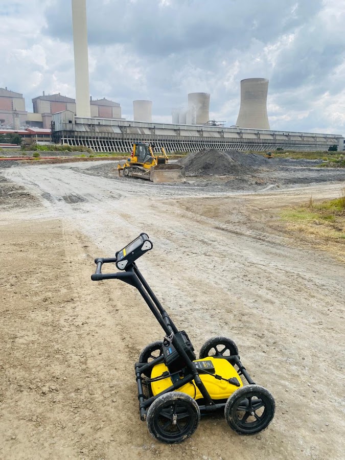
Sensors & Software LMX200 GPR unit at Mpumalanga power station cooling towers

Mpumalanga & North West

Power Station & Industrial Plant Surveys

High-depth Ground Penetrating Radar and electromagnetic locating of critical cooling water pipelines, fire mains, and high-voltage feeders prior to civil upgrades.

Commercial campus underground cable and water line trench verification

Midrand & Sandton, Gauteng

Corporate Campus & Trench Verification

Pre-excavation cable avoidance, fibre-optic duct tracing, and concrete slab scanning before core drilling with georeferenced KML and PDF deliverables.

Nationwide Service Coverage

Regional field hubs. Rapid mobilisation throughout South Africa.

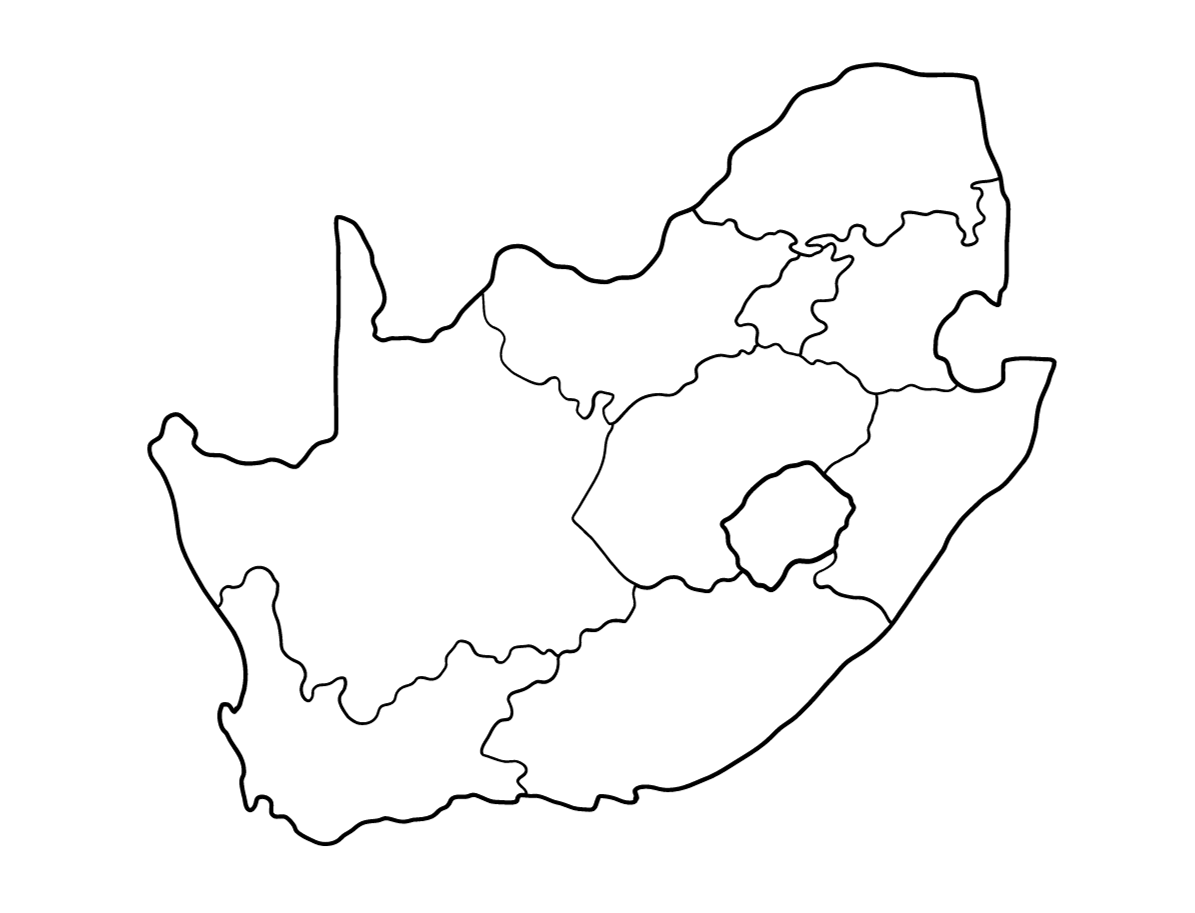
With mobile field crews based in Johannesburg (Gauteng) and Rustenburg (North West), our utility detection and GPR scanning teams deploy directly to your site across all nine provinces. Select a region below to explore local services:

GPR Metrics South Africa nationwide service coverage map
Frequently Asked Questions

Clear answers about GPR scanning & utility locating.

Need specific advice for your site? Call our team directly on 061 766 8359, WhatsApp 061 766 8359, or use our alternative landline 010 746 3891.

Which Rustenburg and North West areas do your field teams cover?

Our Rustenburg-based field crew services Phokeng, Bleskop, Marikana, Mooinooi, Brits, Hartbeespoort, Sun City, Mogwase, Thabazimbi, Koster, Lichtenburg, Potchefstroom, Klerksdorp, and Mahikeng.

Can you provide georeferenced CAD and KML maps for mine engineering drawings?

Yes. We combine Ground Penetrating Radar and electromagnetic locating with Stonex Total Station and GNSS surveying to deliver survey-grade .DWG, .DXF, .KML, and PDF utility maps that integrate directly into mine and plant CAD systems.

Ready to uncover what lies beneath your site?

Book your Ground Penetrating Radar or utility detection survey today and get 10% off your first service.

☎ Call 061 WhatsApp Get Quote ↑